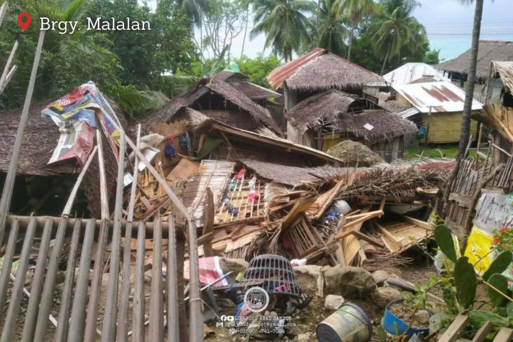
DAVAO CITY, Philippines – Despite ongoing evacuations following a June 8 earthquake that created landslide dams in the municipality of Jose Abad Santos (JAS), the town’s Bureau of Fire and Protection (BFP) issued an urgent warning on Tuesday, June 16, labeling the blocked waterways a “ticking bomb” and urging residents near rivers to remain on high alert.
“Based on our visual assessment, the earthquake-induced river blockage is a ticking bomb,” the BFP-JAS advisory posted on Facebook read.
The agency cited three critical factors.
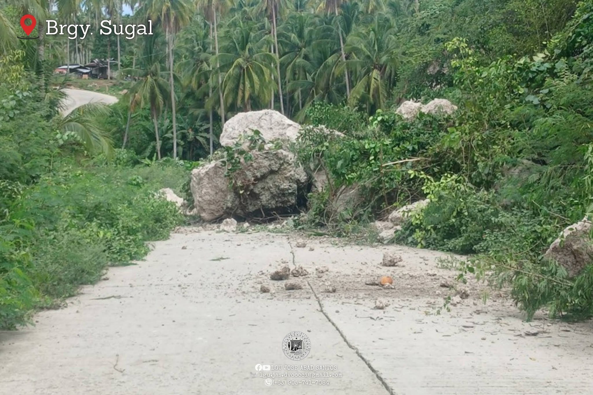
First, continuous rainfall has caused water to pool rapidly behind debris of soil and large rocks, forming an artificial lake.
Second, the dam is unreinforced, composed only of loose earth and stones. As water level rises, pressure builds until the barrier risks bursting or collapsing.
Third, constant aftershocks are destabilizing the structure. These tremors could trigger a sudden fracture or collapse even before the dam becomes fully saturated.
Authorities said residents could face the following threats: a sudden flash flood, like a wall of powerful surge; debris flows carrying logs, mud, and large rocks from the hills that could destroy homes in seconds; and no warning time if the dam breaks, leaving families without opportunity to escape.
To address these dangers, officials outlined urgent and mandatory actions for all communities along affected rivers.
All families in the river’s danger zone were urged to evacuate to higher ground or barangay evacuation centers without waiting for the flooding to occur.
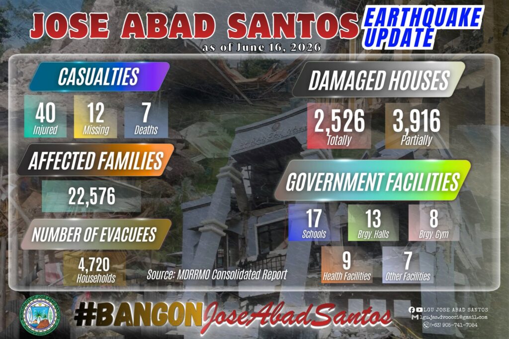
Local government units confirmed that preemptive evacuations had already been completed as of June 14, with no residents remaining in high-risk areas.
Residents were advised to watch for abnormal signals particularly if rain continues but water levels suddenly slow down or drop significantly. This indicates upstream blockage and suggests the dam is nearing collapse. If this is observed, residents must move to higher ground.
Officials remind the residents to follow evacuation orders.
“Material possessions can be replaced but lives cannot,” the advisory read. “Stay alert, work together, and act immediately for everyone’s safety.”
Blasting, pipes for quake-blocked rivers
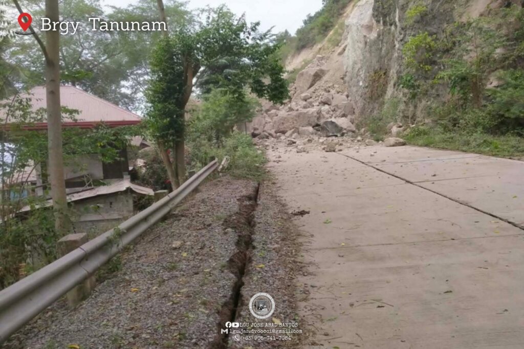
Ednar Dayanghirang, regional director of the Office of Civil Defense (OCD) Region XI, said at least five sites have been identified where soil and debris obstructed small rivers or streams, causing water levels to rise.
He warned that a sudden release of the accumulated water could trigger landslides or flash floods affecting residents living below the blockages.
Dayanghirang outlined three strategies currently under consideration to drain the trapped water:
- controlled blasting to break the soil obstruction and restore natural water flow,
- manual labor, using workers to dig channels along the sides to gradually release water in areas inaccessible to heavy equipment, and
- installation of polyethylene pipes to guide water flow downward from the buildup point, a method Dayanghirang compared to an intravenous dextrose drip.
“We can evaluate this now, install a pipe,” Dayanghirang said during the Kapehan sa Dabaw on Monday, June 15.
“Like we’re putting a dextrose to the pooled water, place the polyethylene pipe where the water has pooled so it will flow through the pipe and go down.”
Ground assessments were being conducted Monday, June 15, by the provincial government of Davao Occidental and JAS to determine the safest and most effective solution. A final decision on which strategy to implement was expected following a meeting later that day.
The OCD and local governments emphasized that while evacuation orders have reduced immediate risk, the removal of the soil blockages remains the primary challenge to preventing further disaster.
Coastal uplift
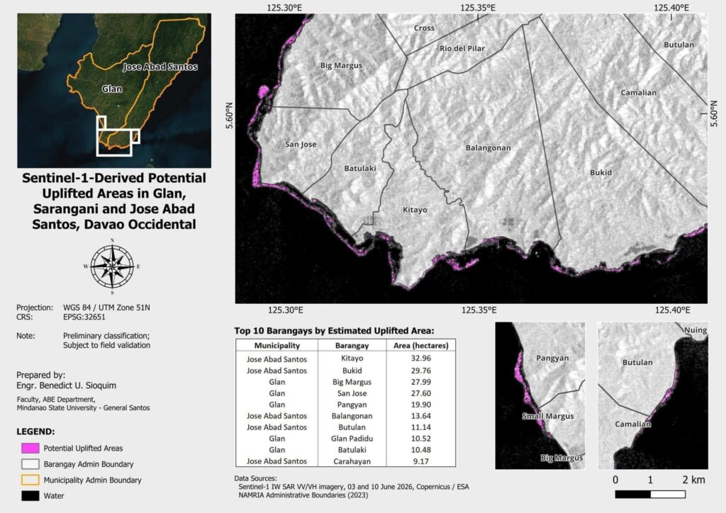
The “receding” ocean reported after the magnitude 7.8 earthquake was actually coastal uplift, where the seabed permanently rose to expose roughly 96 hectares of new land.
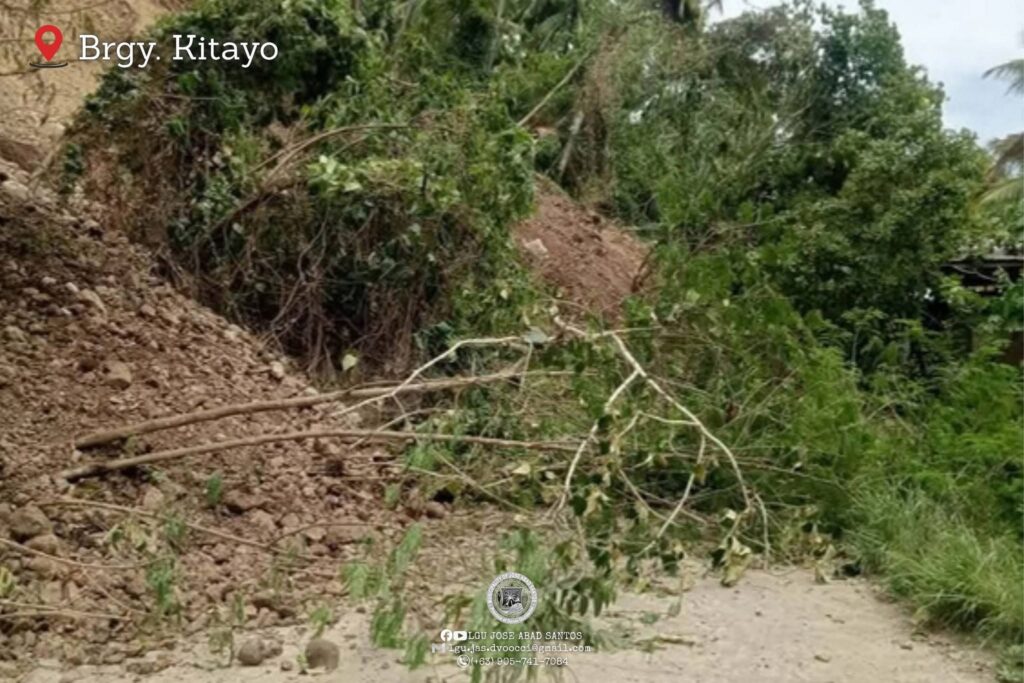
Satellite analysis by Engr. Benedict U. Sioquim of Mindanao State University-General Santos identified the most affected areas as barangays Kitayo (32.96 ha), Bukid (29.76 ha), Balangonan (13.64 ha), Butulan (11.14 ha), and Carahayan (9.17 ha).
“While it appears the water retreated, the ground itself lifted due to tectonic force,” Sioquim said.
However, authorities warned that the newly exposed terrain is unstable, littered with coral and soft soil. Residents were urged to avoid the area and seek higher ground immediately if another strong tremor occurs or if seawater suddenly returns.(Omerahh H. Usman, Ayannah P. Tomandao,Intern/davaotoday.com)