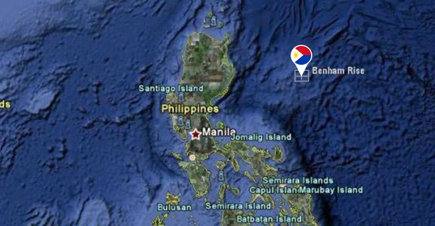
The Benham Rise (map from benhamrise.com)
DAVAO CITY – Marine scientists sailed on Monday, May 23 to discover the biodiversity of the Benham Rise, which covers the country’s new territory.
The marine experts from the Bureau of Fisheries and Aquatic Resources (BFAR), University of the Philippines and Oceana Philippines boarded the government research vessel MV DA-BFAR to sail the Benham Bank.
Oceana is providing remotely operated vehicles and technical diver-videographers during the expedition to get more footage and allow researchers to analyze the marine life in Benham Bank more extensively.
This year’s expedition will also make use of the baited remote underwater video system (BRUVS) to measure fish populations. It uses footage from two cameras attached to a frame with fish-bait at the center, and specially licensed software to estimate fish sizes and analyze the maximum number of fish seen at any one time. This method avoids the problem with double counting of fish that occurs in manual transect surveys.
The United Nations’ Commission on the Limits of the Continental Shelf recognized the extended continental shelf jutting from Benham Rise as the country’s newest territory in 2012.
Rhoda Bacordo, team leader and chief scientist for BFAR, said “several fisheries and oceanographic explorations conducted since 2006 have shown the significance of Benham Rise for food security.”
“This could serve as new alternative fishing grounds for Filipino fishermen, since the area is known as the migration path of fish, including tuna,” she said.
Benham Bank is known for its deep sea reefs that harbor a wide variety of marine life, said Marianne Pan-Saniano, Oceana Philippines marine scientist.
Saniano said, “Oceana is hopeful that whatever new discoveries will be made in this expedition can serve as the basis for crafting a management and conservation plan for this new territory.” (davaotoday.com)


