By DAVAO TODAY
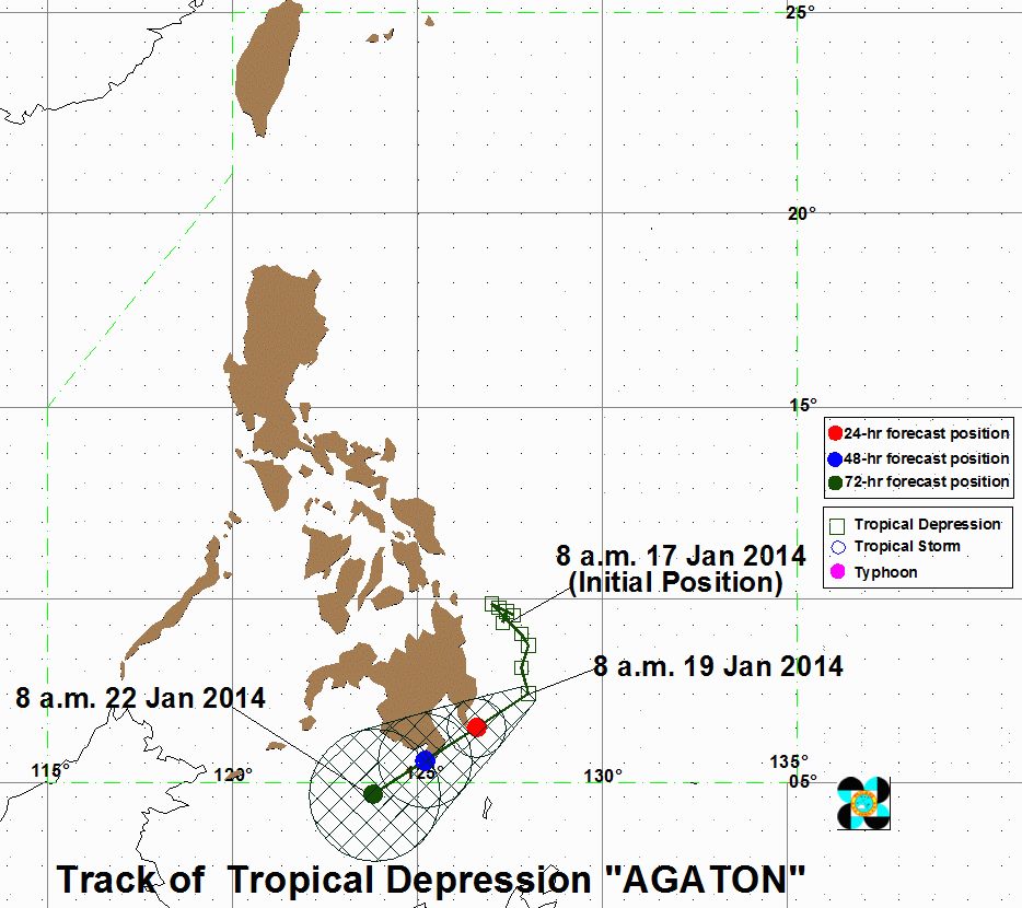
Update from PAGASA as of 11 am Sunday showed that the track of Typhoon Agaton moved further south but would hit Davao Region, including Davao City, by Monday.
While previous public storm warning signal no. 1 was lifted in Surigao del Norte and Agusan del Norte have been lifted, the latest from PAGASA raised storm signal number 1 in – Surigao del Sur, Agusan del Sur, Davao Oriental, Davao del Norte, Davao del Sur and Compostella Valley.
Latest forecast from PAGASA showed that Agaton is expected Monday morning at 120 km Southeast of Davao City and at 60 km South of Gen. Santos City by Tuesday morning. By Wednesday morning, it is expected to be at 220 km Southwest of General Santos City or out of the Philippine Area of Responsibility (PAR).
PAGASA forecast that Agaton will make landfall on Tuesday, 2 am at Mount Hamigutian, Governor Generoso town in Davao Oriental.
The Davao City Disaster Risk Reduction Management Office (CDRRMO) has cancelled all boat trips plying Sta. Ana/ Talicud/ Kaputian. It announced that trips plying Km 11-Villaric Pier in Babak will operate only at daytime and no more boat trips will be allowed after 6 pm.
The Philippine Coast Guard had announced that ferry boats plying Samal Island-Davao City route have been cancelled. (davaotoday.com)
Classes in Compostela Valley have been cancelled, while in Davao Oriental, residents have reportedly evacuated away from shorelines and areas prone to landslides.
Disaster units from Davao Oriental, Davao del Norte and Compostela Valley are now on alert.
The Davao del Norte Provincial Disaster Risk Reduction & Management said the province will not be hit by the eye of the storm but will be affected by heavy rains projected at 5 to 15 mm per hour within the 300 km diameter of the storm.
PAGASA said heavy rains are expected in Northern Mindanao, Caraga, Bohol and Siquijor. (davaotoday.com)
Agaton, LPA, LPA in Mindanao, Tropical Depression


