DAVAO CITY—Seeing Filipino’s enthusiasm in using search engine Google’s Map Maker and realizing that automated elections will change many designated polling stations because of precinct clustering, Filipino Google engineer Dan Cedric Delima designed a tool to help voters get to their assigned polling stations on Election Day this May 10.
Named the Google Precinct Finder, the online tool uses community knowledge to make voter center information accessible to many Filipino voters.
“As we saw during Typhoon Ondoy (international name Ketsana), updated digital maps can be very helpful in a variety of humanitarian situations,” Delima cited, recounting the calamity that struck the country last year, wherein many Filipinos used online maps to direct rescuers to stranded flood victims.
“Now that election season is upon us, what better way to extend Google’s mission of organizing local information and making it useful to Pinoys than to involve the community in tagging voting centers on Google Map Maker,” the General Santos-born Google engineer added.
Using Google Precinct Finder is as simple as dropping a pin on the correct location of the voting center on a map, as Delima puts it.
After clicking on the “Find your precinct” button, users will be taken to a page where they can input the name of the city where they are registered to vote. The site will then display the voting centers located in that city. Users should click on the name of the voting center they want to map, the map will then expand and the users can zoom in the part they choose to verify the location of their voting center. Users can then click on the correct location then click the “Submit” button at the bottom.
Delima says that no technical expertise is required. The tool automatically collects input from users contributing the same information, which will go through the Google Map Maker peer moderation process.
One map feature is also the “Help others find Precincts” link.
According to Delima the map points for these locations can be useful even after the elections. Since most the mapped locations are schools, it can benefit a student attending a school in a new area or relief organizations could more easily find the schools, since they are usually used as evacuation centers during natural disasters.
“Alam ko sa Davao, maraming schools ang nasa looban, mahirap hanapin (I know that in Davao many schools are not located along the highway and are difficult to find), Delima, who spent his high school years in Davao, added. The tool he says will help reduce confusion on where to vote and the location of their new voting centers especially for new Dabawenyo voters.
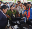
In Davao City, volunteer mappers mostly come from the local blogging community. They recently conducted a precinct mapping party using the Google tool. Bringing their laptops, the mappers began tagging the locations of voting centers along with nearby familiar landmarks using Google’s Map Maker.(PIA XI)
IMPORTANT NOTICE: INBOX is an archive of press releases, statements, announcements, letters to the editors, and manifestos sent to Davao Today for publication. Please email your materials to davaotoday@gmail.com. Davao Today is not responsible for the content of these materials. The opinion expessed in these items does not reflect those of Davao Today and its staff. Please refer to our terms of use/disclaimer.


