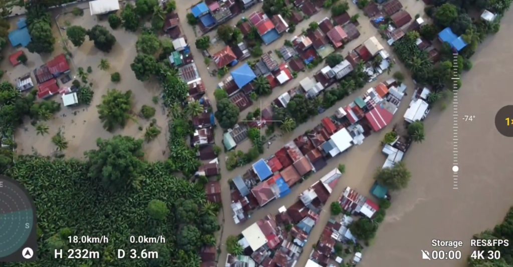
DAVAO CITY, Philippines – Why does Jade Valley Subdivision in Buhangin get submerged in waist-deep flood every time torrents of rain hit the city?
An environment and urban planner, Lemuel Manalo, explained why in his post last February 2 that earned 11,000 shares.
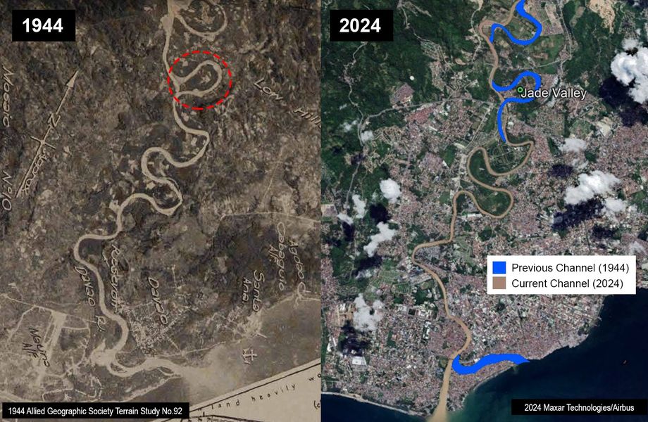
Manalo said Jade Valley was a river decades ago. He discovered this by reviewing historical maps of Davao City and came to a 1944 Allied Geographical Section Survey No. 92, that showed the previous channels of the Davao River. In a process called “georectification” or aligning digitally aerial images of the old and new maps of the area, he discovered, “Jade Valley was the river.”
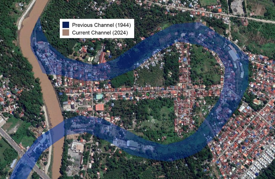
How the river changed its space and disappeared later is part of its natural “play”, Manalo said.
“The geophysics of a floodplain is that the river can naturally “play” along with its channel, it can go linear, curve, bend or erode forming other ways and etc., it’s unpredictable. Probably in the 60s-70s it shifted to its current form, abandoning the old channel, some dried up and deep portions became “Oxbow Lakes” (wetland remnants from the old channel or bend),” he elaborated.
“Sadly, a subdivision was developed at these low-lying areas without risk assessments or even extensive elevation-filling works,” this is how he sees what is happening to Jade Valley.
Now with huge rainfall causing the Davao River to rise just like what happened on January 30, he points out that “floodwater forces to enter back to its old channel and drainage lines. If the volume and pressure is strong, it fills-up the entire floodplain” including the subdivision.
Manalo said that in this scenario, no amount of fixing the drainage in the area would solve the problem. “In the first place, river meanders should be uninhabitable,” he said.
Rescue operations or forced evacuation of the residents will be exhausting if floods keep happening in the next ten years.
His suggestion is to find relocation and utilize the Jade Valley for better purpose such as making it a basin for flood control.
“The last option perhaps is that the government will procure the area and facilitate a socially-just relocation process for the residents in order to use the land to construct a Stormwater Retarding Basin. It’s a strategic yet feasible location to hold and delay floodwater, reducing risks to communities downstream, particularly in Maa, Bangkerohan, Sandawa to Bucana.”
Lemuel Manalo is the program coordinator of Interfacing Development and Interventions for Sustainability (IDIS) and a member of the Philippine Institute of Environmental Planners. He also teaches at the University of Southeastern Philippines. (davaotoday.com)